
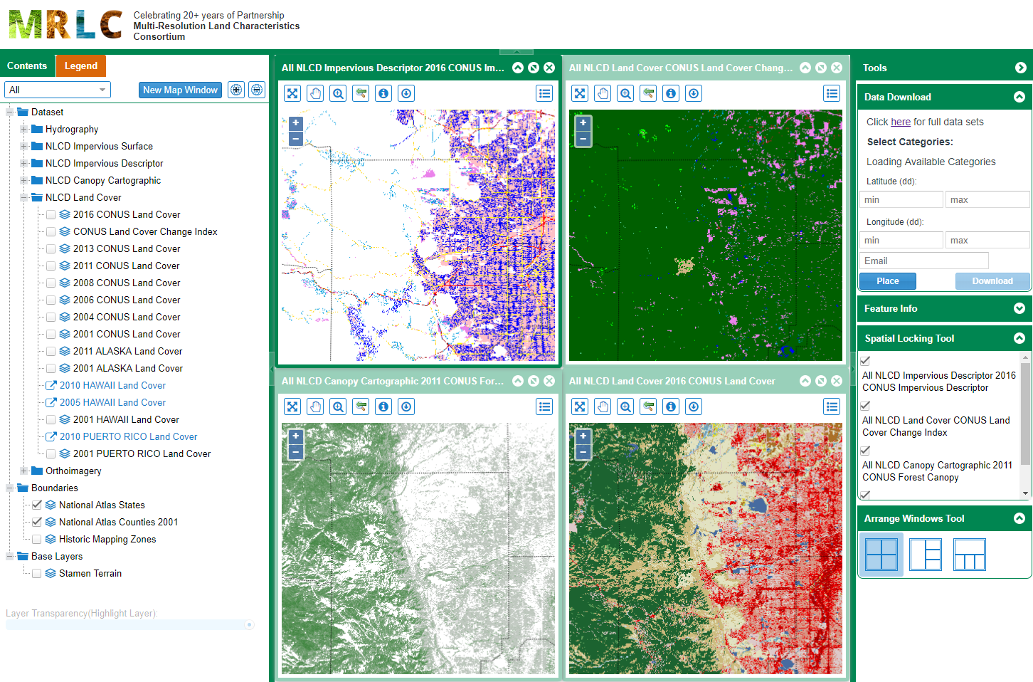
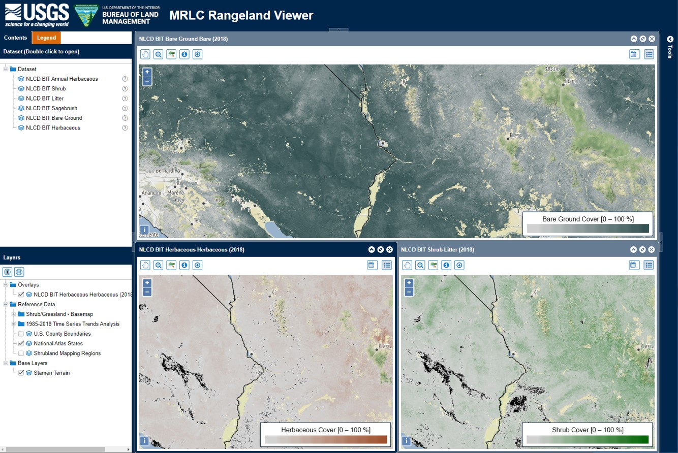
MRLC provides several tools to allow users to interact with data, download custom extents, and support quick analysis. The NLCD Viewer enables user interactivity with the NLCD product suite, the Rangeland Viewer provides a dynamic platform to interact with RCMAP data, and the NLCD EVA tool provides county level analysis and statistics on NLCD land cover change.

RCMAP 1985-2023 Fractional Component Time-Series Now Available
Published
The RCMAP product suite includes 10 components: annual herbaceous, bare ground, herbaceous, litter, non-sagebrush shrub, perennial herbaceous, sagebrush, shrub, tree, and shrub height. Data characterize the percentage of each 30-meter pixel in the Western United States covered by each component for each year from 1985-2023 - providing change information for 39 years. Because of file size limitations, individual years of component cover data are packaged in three time intervals including 1985-1996, 1997-2008, and 2009-2023. Perennial herb and non-sagebrush shrub are derivatives of herbaceous and annual herbaceous cover, and shrub and sagebrush cover, respectively.
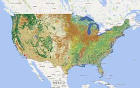
NLCD 2021 Now Available
Published
The U.S. Geological Survey (USGS), in association with the Multi-Resolution Land Characteristics (MRLC) Consortium, is pleased to announce the completion and release of the latest epoch of the National Land Cover Database (NLCD) for the conterminous U.S.—NLCD 2021. The MRLC, a consortium of federal agencies who coordinate and generate consistent and relevant land cover information at the national scale for a wide variety of environmental, land management, and modeling applications, have been providing the scientific community with detailed land cover products for more than 30 years. Over that time, NLCD has been one of the most widely used geospatial datasets in the U.S., serving as a basis for understanding the Nation’s landscapes in thousands of studies and applications, trusted by scientists, land managers, students, city planners, and many more as a definitive source of U.S. land cover.
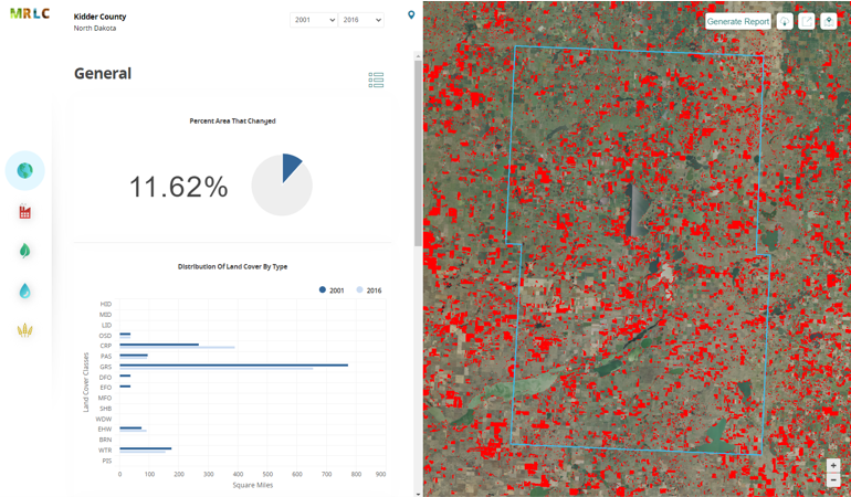
Enhanced Visualization and Analysis (EVA) Tool Now Available
Published
The MRLC Consortium, in collaboration with NOAA and the USGS, is pleased to release version 2 of the Enhanced Visualization and Analysis (EVA) tool. This tool provides users with detailed county statistics for any two NLCD landcover dates to support quick and powerful change analyses. This tool was originally developed by NOAA and shared through the consortium with custom adaptations for NLCD.