News Content
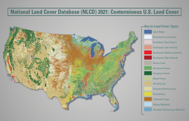
The U.S. Geological Survey (USGS), in association with the Multi-Resolution Land Characteristics (MRLC) Consortium, is pleased to announce the completion and release of the latest epoch of the National Land Cover Database (NLCD) for the conterminous U.S.—NLCD 2021. The MRLC, a consortium of federal agencies who coordinate and generate consistent and relevant land cover information at the national scale for a wide variety of environmental, land management, and modeling applications, have been providing the scientific community with detailed land cover products for more than 30 years. Over that time, NLCD has been one of the most widely used geospatial datasets in the U.S., serving as a basis for understanding the Nation’s landscapes in thousands of studies and applications, trusted by scientists, land managers, students, city planners, and many more as a definitive source of U.S. land cover.
News Image
News Link