")

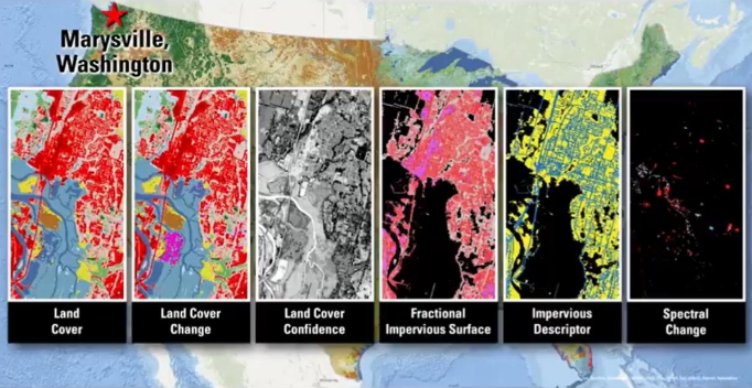
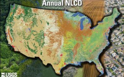
The Multi-Resolution Land Characteristics (MRLC) consortium is a group of federal agencies who coordinate and generate consistent and relevant land cover information at the national scale for a wide variety of land resource monitoring and modeling applications. The creation of this consortium has resulted in the mapping of the lower 48 United States, Hawaii, Alaska and Puerto Rico into a comprehensive land cover product termed, the National Land Cover Database (NLCD), from decadal Landsat satellite imagery and other supplementary datasets.
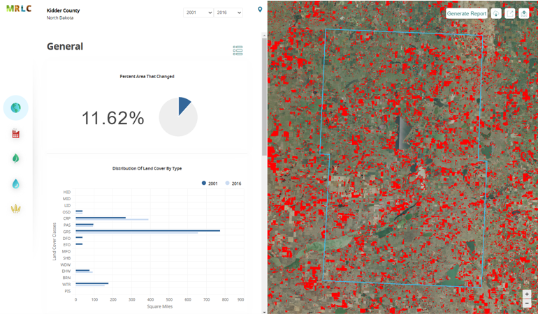
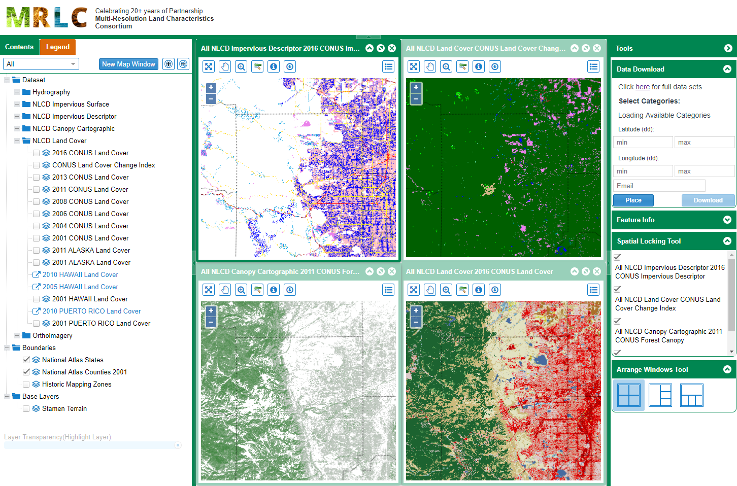
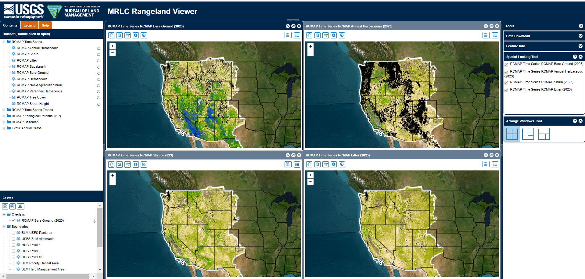
MRLC hosts land cover and land condition data from various sources, including Annual NLCD, legacy NLCD, Rangeland Condition Monitoring Assessment and Projection (RCMAP) time-series fractional rangeland components, and RCMAP weekly data on Exotic Annual Grass and Herbaceous cover. Data are offered for download, as WMS services, and through web applications.