CEC’s North American Land Change Monitoring System (NALCMS) is a collaborative initiative with Natural Resources Canada (NRCan)’s Canada Centre for Mapping and Earth Observation (CCMEO), the United States Geological Survey (USGS), and three Mexican agencies: the National Institute of Statistics and Geography (Instituto Nacional de Estadística y Geografía—INEGI), the National Commission for the Knowledge and Use of Biodiversity (Comisión Nacional para el Conocimiento y Uso de la Biodiversidad—Conabio), and the National Forestry Commission (Comisión Nacional Forestal—Conafor).
Since NALCMS began in 2006, specialists from the CEC and these governmental agencies have worked together to devise, through a collective effort, a harmonized multi-scale land cover monitoring framework that can be applied across North America with high accuracy, meeting each country’s specific requirements. To learn more about the NALCMS initiative, visit http://www.cec.org/nalcms.
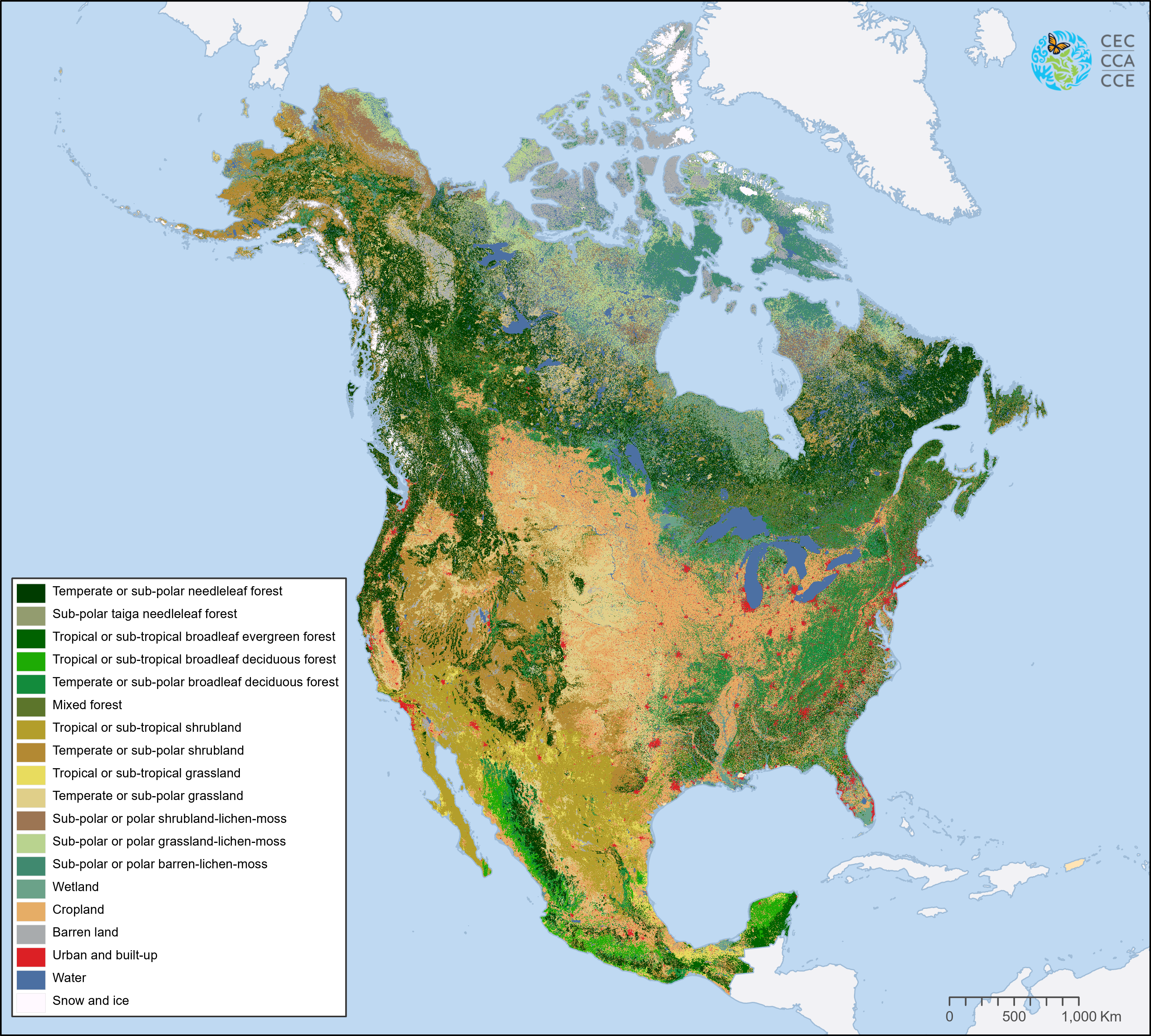
A series of both 250m and 30m landcover products have been produced starting for 2005. The latest product is a 30-meter spatial resolution 2020 landcover for North America. This new land cover map, created from a composite of images assembled from satellite observations (Landsat), harmonizes land cover classification into 19 comparable classes across Canada, Mexico and the United States. The NALCMS land cover classes are based on the Land Cover Classification System (LCCS) standard developed by the Food and Agriculture Organization (FAO) of the United Nations.
The NALCMS land cover mapping products are available through the CEC’s North American Environmental Atlas (http://www.cec.org/Atlas), a collection of harmonized geospatial data from Canada, Mexico and the United States giving a continental perspective on transboundary environmental issues.