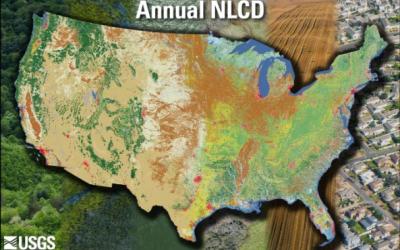
NLCD imperviousness products represent urban impervious surfaces as a percentage of developed surface over every 30-meter pixel in the United States. The NLCD 2021 release is update based, so the Impervious Surface products released in 2019 are unchanged and can be used directly with NLCD 2021.This update provides integrated analysis throughout all dates and includes a matching impervious surface descriptor layer. This descriptor layer identifies types of roads, wind tower sites, building locations, and energy production sites to allow a deeper analysis of developed features. No new imperviousness products for Alaska, Hawaii and Puerto Rico are available for NLCD 2021. For additional information regarding creation of NLCD percent developed imperviousness products:
Dewitz, J., and U.S. Geological Survey, 2021, National Land Cover Database (NLCD) 2019 Products (ver. 2.0, June 2021): U.S. Geological Survey data release, https://doi.org/10.5066/P9KZCM54
Xian, G., Homer, C., Dewitz, J., Fry, J., Hossain, N., and Wickham, J., 2011. The change of impervious surface area between 2001 and 2006 in the conterminous United States. Photogrammetric Engineering and Remote Sensing, Vol. 77(8): 758-762. Yang, L., Huang, C., Homer, C., Wylie, B., and M. Coan. 2003. An approach for mapping large-area impervious surfaces: Synergistic use of Landsat 7 ETM+ and high spatial resolution imagery. Canadian Journal of Remote Sensing, Vol. 29, No. 2, pp.230-240.