NLCD 2016 is an ongoing land cover modeling production effort with NLCD scientists providing expertise in research and development, modeling, scripting, scene selection, cloud-masking, land cover mapping, and imperviousness mapping production.
- NLCD 2016 Product Highlights
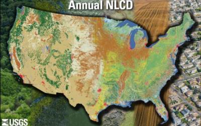
- Land cover and imperviousness products will be available for 7 product dates between 2001 and 2016 including 2001, 2004, 2006, 2008, 2011, 2013, and 2016.
- Land cover and imperviousness products will be spatially and temporally consistent among the 7 product dates
- An improved look and feel to NLCD land cover will be accomplished by integrating pixel based and shape based classifications and new ancillary data layers
- Incorporation of new shrub and grass mapping in the Western U.S. is being completed. This will provide separate fractional vegetation products for download, and also be incorporated into the land cover for improved accuracy
- Look for a release of the NLCD 2016 products early 2019!