Where can I find documentation related to Annual NLCD data?
- The Annual NLCD Science Product User Guide describes the relevant characteristics of the Annual NLCD Collection 1 Science Products to facilitate their use in the land cover remote sensing community. The Annual NLCD Science Product User Guide can be found on the Annual NLCD website. We also recommend reviewing the Annual NLCD Characteristics, Constraints, and Caveats when working with the data.
How often are new Annual NLCD data released?
- Annual NLCD updates will occur annually in the late spring / summer.
Will areas outside of CONUS be included in the Annual NLCD dataset?
- Yes, each region will have its own collection and version. When these datasets are available, they will be called “Annual NLCD Hawaii Collection 1 Version 0” and “Annual NLCD Alaska Collection 1 Version 0” respectively.
Is the “All Years” dataset still available?
- The Legacy “All Years” dataset is no longer distributed in its original bundled format. However, Annual NLCD products are available as four pre-bundled conterminous United States (CONUS) zip files spanning the years 1985 to 2024 through the MRLC Direct Download Site. Legacy NLCD data remain accessible through ScienceBase for users who need them.
Are Annual NLCD data available outside of CONUS?
- Currently, Annual NLCD data is only available for CONUS.
Outside of CONUS, Legacy NLCD products are available for Hawaii (as recent as 2001), Alaska (as recent as 2016), and Puerto Rico (as recent as 2001).
All these data can be accessed through the MRLC Direct Download Site. USGS is currently developing NLCD for Hawaii and Alaska for future releasees.
What is the difference between Legacy NLCD and Annual NLCD?
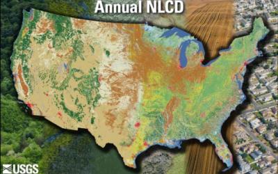
- Since 1992, NLCD data, derived from the Landsat satellite record, have provided nationwide land cover and land cover change information. Data is offered at a 30-meter spatial resolution, with detailed characteristics of the land surface, such as thematic classes (e.g., urban, agriculture, forest), percent impervious surface, and percent tree canopy cover. Legacy NLCD includes map products for nine distinct epochs between 2001 and 2021 (2001, 2004, 2006, 2008, 2011, 2013, 2016, 2019, and 2021). These datasets are no longer produced; users are encouraged to transition to the Annual NLCD data.
Annual NLCD introduced a new methodology that leverages an ensemble of chained deep learning modules and harmonic time series analysis. This approach enables the creation of validated annual land cover and related products spanning nearly four decades, with annual updates. First released in 2024, Annual NLCD is a record of land cover and fractional impervious surface for CONUS, available annually back to 1985.
Why are there discrepancies between my previous Legacy NLCD data results and the newer Annual NLCD data for the same years, and can I still compare them?
- Legacy NLCD data are not directly comparable to the newer Annual NLCD data due to differences in methodologies, inputs, and ancillary data. These differences can lead to discrepancies in land cover classification, where the “differences” may reflect methodological changes rather than actual land cover change. For accurate analysis, you should only compare data from the same release (e.g., comparing 2001 data from the 2021 release with the 2021 data from the same 2021 release). Legacy data spans from 2001 to 2021 and is consistent within each release, but comparing across different releases or with Annual NLCD data will yield inaccurate results. To conduct a proper analysis, it is best to download the currently released data for the specific years you are interested in.
What is the spatial resolution of Annual NLCD data?
- Annual NLCD data are raster based and derived from Landsat satellite imagery at a 30-meter resolution.
Why does Annual NLCD use WGS84 as its datum?
- World Geodetic System 1984 (WGS84) was adopted by the Landsat program as the base for the Albers projection. Landsat uses WGS84 because it is the globally recognized standard coordinate system, ensuring consistency and interoperability with other data sources. This allows for accurate geolocation and seamless integration with other mapping systems, particularly those utilizing GPS technology, which also rely on WGS84 as their reference point. Essentially, WGS84 provides a single, widely accepted framework for mapping the Earth's surface across different applications and uses. NLCD adopted this standard to be able to use an Albers projection that did not require resampling.
How can I learn more about the accuracy of these datasets?
- The validation of Annual NLCD Collection 1.0 was released in July of 2025. Additional information on Reference and Validation can be found on the Annual NLCD website, here.
How do I cite Annual NLCD data?
- The citation for Annual NLCD data is as follows:
U.S. Geological Survey (USGS), 2024, Annual NLCD Collection 1 Science Products: U.S. Geological Survey data release, https://doi.org/10.5066/P94UXNTS.
Do you have any real-world examples of how these data are or could be used?
- Yes, please see our land change stories for existing and potential use case examples.
Who can I reach out to if I have questions about the data?
- For any questions related to the data or how to access the data, please contact our User Services team via custserv@usgs.gov or call them directly at 1-800-252-4547.
Accessing Annual NLCD data:
How can I access and download Annual NLCD data?
- The Annual NLCD Collection 1 Product Suite can be accessed through a variety of methods:
Users interested in receiving all the data over CONUS, or a larger region, can download the files for the entire time series (1985–2023) via zipped files using the MRLC Direct Download Site.
For spatial and temporal filtering, the MRLC NLCD Viewer provides interactive tools to define areas of interest using the rectangle and polygon draw tools, or by uploading a singlepart shapefile or GeoJSON. Please note: if your shapefile contains multiple parts, you will need to convert it to a singlepart shapefile before using it with the viewer. Users can then select specific Annual NLCD layers and temporal ranges from within the tool. The resulting clipped GeoTIFF is generated and delivered via email. Please note: delivery can take up to a few hours, depending on how many users are using the viewer at the same time. This viewer also supports Zonal Histogram Plotting at the county level, offering summaries by area percentage or square kilometers.
For advanced county-level analytics and visualization, users can utilize the MRLC NLCD EVA Tool, which delivers detailed charts and statistical breakdowns of Annual NLCD data.
Users interested in OGC Services can access the data through WMS and WCS layers. Implementation details are available on the Data Services Page.
Alternatively, for scalable and programmatic data access, cloud-based access is available via the USGS AWS S3 (Oregon us-west-2 region).
Annual NLCD data, as well as previous versions of the data, can also be found on ScienceBase.
Annual NLCD data are also available via EarthExplorer (EE) for USGS EROS Users who prefer that tool. Listed under the “Land Cover” category as Annual NLCD Collection 1.0, the data are provided as Landsat ARD tiles. With the release of Collection 1.1, EE will offer data bundled across time, which will make it easier to download time series for smaller areas.
What data formats are Annual NLCD data available in?
- Annual NLCD data are available in the GeoTIFF data format.
Can I download the Annual NLCD data as a CSV file?
- No, you cannot download the Annual NLCD data as a CSV file. The whole CONUS dataset contains over 80 million pixels, which can be difficult for spreadsheet software to process.
Can I download Annual NLCD data as a shapefile?
- No, you cannot download Annual NLCD data as a shapefile.
Can I download Annual NLCD data over a specific study area?
- Yes, Annual NLCD data can be downloaded over a specific Area of Interest (AOI) using the MRLC NLCD Viewer. You can either utilize the rectangle or polygon feature to manually set your AOI, or you can upload a single attribute shapefile or GeoJSON of your AOI. This will allow you to download data of your AOI. Please note: the accompanying charts and graphs in the MRLC NLCD Viewer and the MRLC NLCD EVA Tool are currently only available at the county level.
Who can I reach out to if I have questions or issues while trying to access the data?
- For any questions related to the data or how to access the data, please contact our User Services team via custserv@usgs.gov or call them directly at 1-800-252-4547.
Why does NLCD not display in the correct legend colors in ArcPRO?
- Data values/labels/legend color palette may not load correctly when importing Annual NLCD products into ESRI software products. Load the correct legend and data values by using the ‘Build Raster Attribute Table’ tool. You must select the ‘overwrite’ and ‘convert colormap’ checkboxes.