
News Content
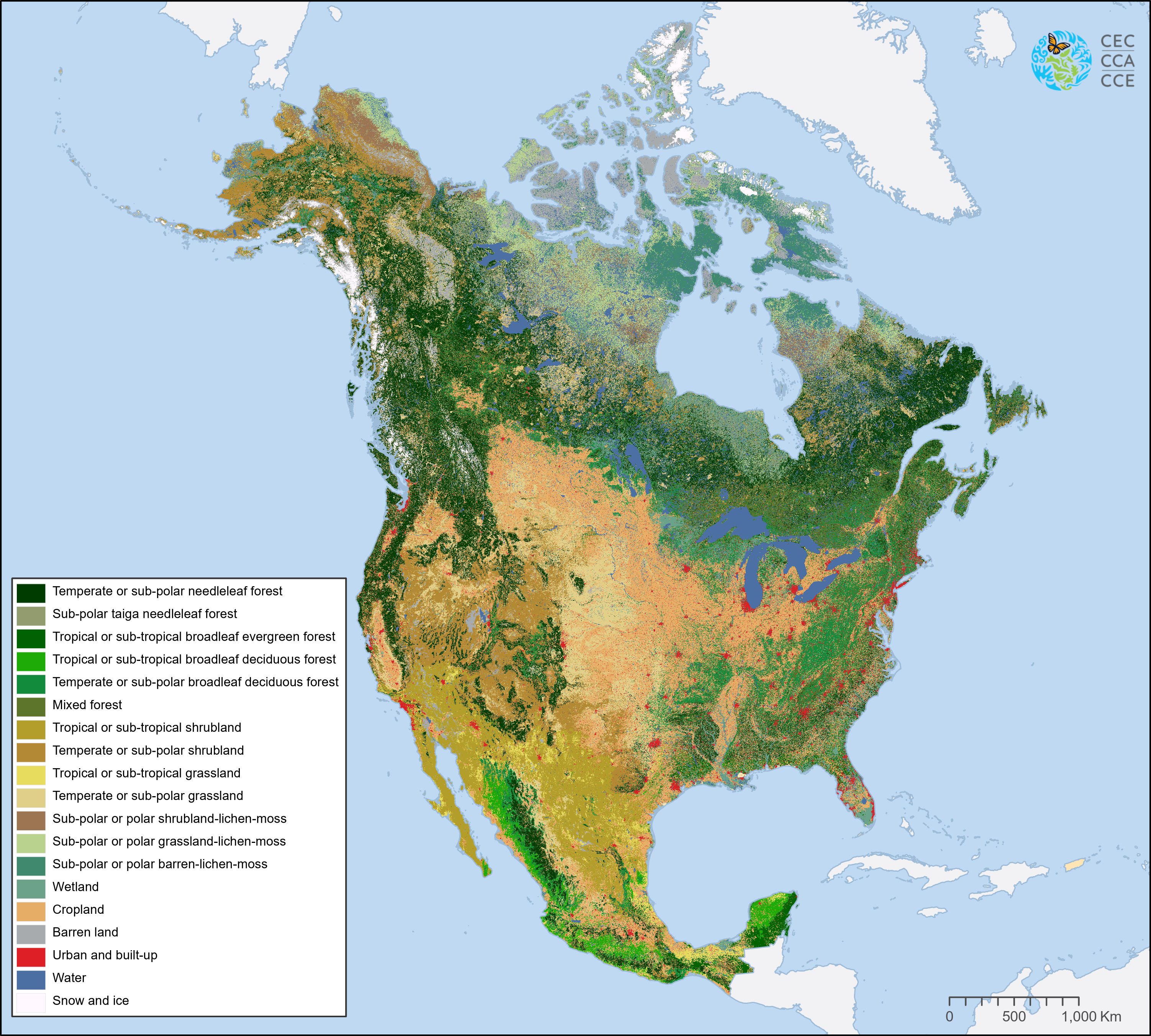
Montreal, 20 March 2023 — The Commission for Environmental Cooperation (CEC) is pleased to release the latest trinational digital land cover map of North America, under the North American Land Change Monitoring System (NALCMS), a collaboration with the Governments of Canada, Mexico and the United States and their respective mapping agencies. This land cover map is the most accurate map available at this scale and is publicly available through the North American Environmental Atlas.
News Image
News Link


