
News Content
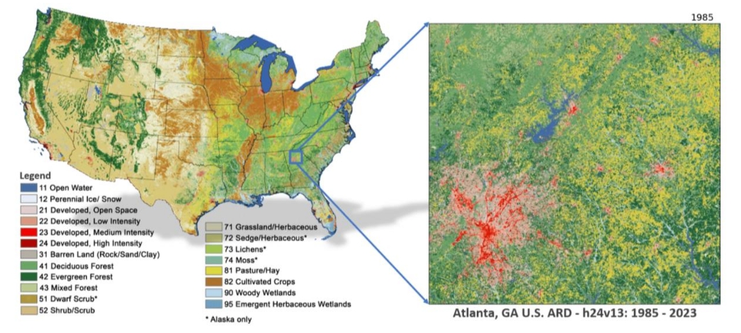
The first release of annual land cover mapping data is now available for the Conterminous United States (CONUS). With this release, Annual National Land Cover Database (NLCD) offers insights into land cover and land cover change characteristics across CONUS from 1985 to 2023 through the following products:
1. Land Cover – provides 16 land cover classes such as deciduous and evergreen forest, grassland, cultivated crops and developed.
2. Land Cover Change – Represents annual land cover changes between one year and the next.
3. Land Cover Confidence – confidence levels for the land cover classifications.
4. Fractional Impervious Surface – Provides the proportion of land covered by developed surfaces, such as roads and rooftops.
5. Impervious Descriptor – offers additional information about impervious surfaces by distinguishing between roads and other built surfaces.
6. Spectral Change Day of Year – Captures the specific day of the year when significant changes in surface reflectance occur.
News Image
News Link


