The Multi-Resolution Land Characteristics (MRLC) consortium is a group of federal agencies who coordinate and generate consistent and relevant land cover information at the national scale for a wide variety of land resource monitoring and modeling applications. The creation of this consortium has resulted in the mapping of the lower 48 United States, Hawaii, Alaska and Puerto Rico into a comprehensive land cover product termed, the National Land Cover Database (NLCD), from decadal Landsat satellite imagery and other supplementary datasets.
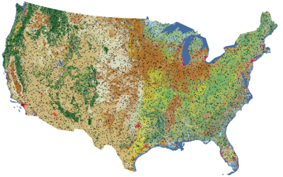
Annual NLCD Reference Data and Validation Metrics Now Available on MRLC
Published
The U.S. Geological Survey has added a new outlet for Reference and Validation (R&V) data for Annual National Land Cover Database (NLCD) Conterminous U.S. (CU), Collection 1.0. In addition to availability on the USGS ScienceBase-Catalog, the R&V data are now hosted right here on MRLC.gov.These R&V data provide Annual NLCD users with a statistical accuracy assessment of the land cover products, as well as the source reference data. This information helps users understand the accuracy of Annual NLCD and supports better decisions in research, land use planning, and resource management.
RCMAP Ecological Potential Data Now Available
Published
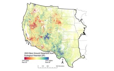
A new generation of RCMAP Ecological Potential (EP) vegetation cover components are now available. Rangelands have immense inherent spatial and temporal variability, yet assessments of land condition and trends are often assessed relative to the condition of a limited number of representative points or in some cases reference data for comparison is lacking. Understanding of the potential vegetation conditions of a site in an undisturbed state is invaluable for interpreting trends, disturbance impact, and restoration targets. EP was defined as the potential fractional cover of components (bare ground, herbaceous, litter, shrub, sagebrush, and tree) in the least disturbed and most productive spaces and times of western North America since 1985. This dataset enables: 1) setting realistic expectations for restoration and management targets, 2) better understanding of the extent of vegetation departure from potential and 3) improved spatial understanding of vegetation composition and productivity variation.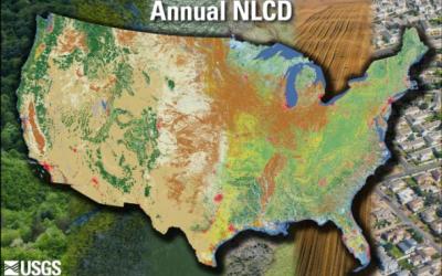
Annual NLCD CONUS Collection 1.1 Now Available
Published
Land Cover Characteristics in a Suite of Six ProductsAnnual NLCD CU C1.1 adds 2024 to the established suite of six raster-based land use and land cover science products for the conterminous United States. It now covers the period between 1985 and 2024:
1. Land Cover
2. Land Cover Change
3. Land Cover Confidence
4. Fractional Impervious Surface
5. Impervious Descriptor
6. Spectral Change Day of Year

