
Image
Description
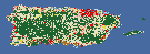
Version 1.0 of the land cover layer for Puerto Rico for all pixels.
Map Services
References Page
Statistics Page

Published
The U.S. Geological Survey Rangeland Condition Monitoring Assessment and Projection (RCMAP) Exotic Annual Grass (EAG) team is pleased to announce the release of a new generation of weekly resolution maps. We initially release weekly data for 2026 weeks 10-16 (March 11 – April 15) for total herbaceous, total EAG, cheatgrass, medusahead, field brome, and Sandberg’s Bluegrass. This will be followed by weekly releases through week 38 (late September) of 2026. Weeks 10-38 of 2016-2025 will also be processed and distributed in summer 2026.
Published
The USDA Forest Service Geospatial Office (GO) builds and maintains the National Tree Canopy Cover (TCC) dataset as part of the National Land Cover Database (NLCD). Annual data for areas outside the contiguous United States is now available from 1985-2023. This includes Southeast Alaska, Hawaii, Puerto Rico and the U.S. Virgin Islands. The TCC datasets are derived from Landsat and Sentinel-2 imagery along with USDA Forest Service - Forest Inventory and Analysis (FIA) data, based on a spatial resolution of 30 meters. Each Tree Canopy Cover (TCC) value is determined using photo interpretation methods and machine learning models, to produce the percentage of the area covered by tree canopy and interannual change between all years.
Published
The U.S. Geological Survey has added a new outlet for Reference and Validation (R&V) data for Annual National Land Cover Database (NLCD) Conterminous U.S. (CU), Collection 1.0. In addition to availability on the USGS ScienceBase-Catalog, the R&V data are now hosted right here on MRLC.gov.